
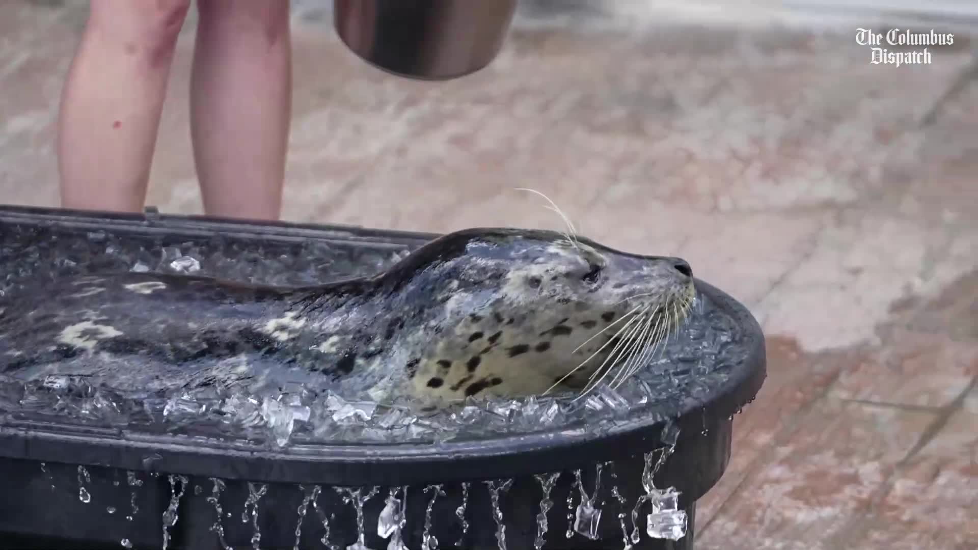
Columbus Zoo & Aquarium: How animals are kept cool in the heat
See how the Columbus Zoo & Aquarium keeps animals safe and cool during extreme heat with shaded areas and special care from staff.
You may want to make sure your air conditioning is working. Columbus, and a sizable chunk of the nation, is in for a scorcher of a week with heat index values as high as 105 degrees possible on July 24 and 25, according to the National Weather Service in Wilmington.
Daytime high will climb into the 90s starting on Wednesday and remain there at least until Monday, with a brief dip into the 80s on Saturday, according to an NWS forecast. That’s just the air temperature. Humidity will make those temperatures feel much warmer.
If you’re headed to the Ohio State Fair this week, you might want to hydrate and make sure you know a few places to beat the heat. But don’t forget your umbrella.
Those hot temperatures won’t be accompanied by clear skies as showers and thunderstorms are in the Columbus forecast Thursday through Sunday.
What were the hottest July days in Columbus?
While the heat index this week will make central Ohio feel more like the Louisiana bayoy, Columbus will get nowhere near the hottest recorded air temperature for July, according to the NWS.
Two July days are among the hottest on record.
They were July 14, 1936, and July 21, 1934, which both reached highs of 106 degrees.
Columbus weather for the week of July 22, 2025
- Tuesday Night: It will be mostly clear with a low around 63. There will be an east wind of around 6 mph that will become calm in the evening.
- Wednesday: It will be sunny with a high near 91. There will be a calm wind that will start moving south around 5 mph in the afternoon.
- Wednesday Night: It will be mostly clear with a low around 70. There will be a south wind of around 5 mph that will become calm in the evening.
- Thursday: There is a slight chance of showers and thunderstorms after 2 p.m. It will be sunny with a high near 94. There will be a southwest wind of 3 to 7 mph. The chance of precipitation is 20%.
- Thursday Night: It will be mostly clear with a low around 75.
- Friday: Showers and thunderstorms are likely, mainly after 2 p.m. It will be partly sunny with a high near 92. The chance of precipitation is 60%.
- Friday Night: Showers and thunderstorms are likely before 2 a.m., then there is a chance of showers. It will be mostly cloudy with a low around 73. The chance of precipitation is 60%.
- Saturday: Showers are likely with thunderstorms also possible after 2 p.m. It will be mostly cloudy with a high near 87. The chance of precipitation is 70%.
- Saturday Night: There is a chance of showers and thunderstorms. It will be mostly cloudy with a low around 73. The chance of precipitation is 40%.
- Sunday: There is a chance of showers and thunderstorms. It will be partly sunny with a high near 90. The chance of precipitation is 40%.
- Sunday Night: It will be partly cloudy with a low around 73.
- Monday: It will be sunny with a high near 92.
Breaking and trending news reporter Nathan Hart can be reached at NHart@dispatch.com and at @NathanRHart on X and at nathanhart.dispatch.com on Bluesky.